Old Courthouse Spring Branch flows through a natural wooded area deep in Tysons Corner. It could best be described as an interstitial natural area. The land covers a wooded stream bottom, sandwiched between developed commercial property and dense residential subdivisions. The total natural area is about 35 to 40 acres. It is almost exactly a mile long, but is only about 140 yards wide at the narrowest point. As if this long, narrow swath was not besieged enough simply by its location, active suburban and commercial infill has removed many of the adjoining natural areas, while at the same time creating more uncontrolled runoff. The effects of the scouring from overflowing storm water are particularly distressing in the northern half of the woodland.
The natural area is 80% Fairfax County Park Authority (FCPA) property. It appears not to be a park, per se, but there are numerous references to it as an EQC. Old Courthouse Spring Branch eventually flows into Wolf Trap Stream, which flows through Wolf Trap Stream Valley Park. The FPCA owns two different parcels, the part north of the old Ash Grove Road which was acquired along with Ash Grove Historic Site, and the majority of the southern part of the area.
There is a central piece that is owned entirely by the homeowners to the west and the commercial office buildings to the east. Hopefully due to its being an EQC and protected wetland area, the land has been maintained pretty much in a "slightly improved" natural state. The owners should be commended for their stewardship. Unfortunately, this is also the area most adversely affected by storm runoff, with the problem becoming much worse in the last few years (2003-2004). A cattail marsh was removed several years ago and converted to a mowed grass drainage area. While this has not appeared to contribute to storm water management, it has completely eliminated red-winged blackbirds from the area.
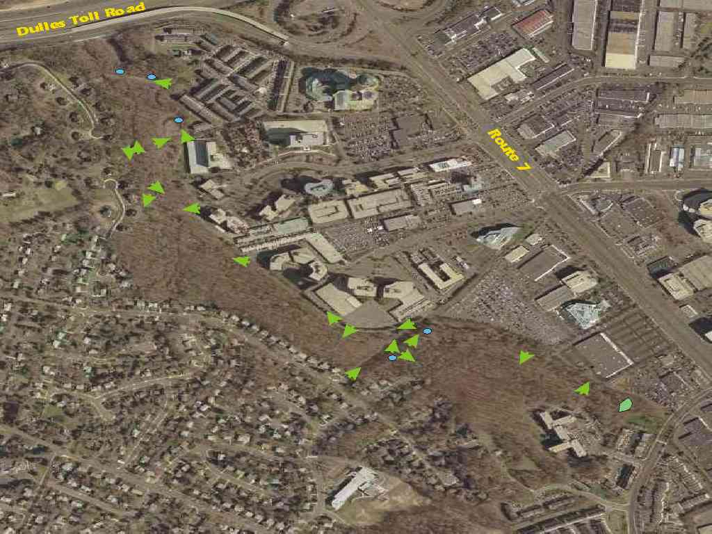
The image below is an aerial view of the woodland. The arrows depict photos from within the natural area. "Mouse over" the arrows for descriptive text, and click on them to see the ground level images.
Ash Grove Historic Site history and general management plan, explaining some of the features of the area north of the old Ash Grove Lane.
Future: observed species lists, bluebird trail project